Black Country

Here is another brief extract from my book Westering that was published earlier this year by Saraband. This time it concerns my transit on foot through the territory of the Black Country that lies to the west of Birmingham. I have included a few black and white images to illustrate the text here. These are not in the book itself but might help give a flavour of what the area is like.

Extract from Chapter 15 – City of Metal

Here was the Black Country and now I was walking on sunshine: the sunshine that lay captured in carbon in the earth below. The sunshine trapped by swampy tropical forests of trees and ferns that, over tens of millions of years of compression, had transformed to a solid energy-rich fuel source; the black rock that set the Industrial Revolution in motion around two hundred years ago – a period of time that on the geological scale of things was little more than a blink of an eye.

Thanks to the thirty-foot-thick seam of coal beneath the ground, Oldbury was at the forefront of the Industrial Revolution. Four blast furnaces operated in its vicinity between the 1780s and 1860s but, as the fortunes of coal mining and steel-making declined in the region in the late 19th century, brick-making took over, exploiting the deposits of Etruria marl that were also found in abundance beneath the coal seam. The town’s underlying geology was generous to a fault: the clay was perfect for manufacturing Staffordshire blue brick, a hard-wearing, non-porous brick ideal for use in foundations, bridges, steps and tunnels – the essential hardware of Black Country business. Tar distilling, chemical manufacturing and boiler-making industries also took root in the district later on. The inevitable result was a besmirched landscape – a ‘black country’ – an environment littered with spoil heaps, abandoned quarries, cavernous marl pits and unbridled chemical pollution. In its heyday, the Black Country had been highly productive – a soot-blasted territory of glowing foundries and clanging metal – but now that energy has drained away.

Extract from Chapter 16 – Black over Bill’s Mother’s

At Brierley Hill I came across a new waterfront development complex that was named, somewhat unimaginatively, The Waterfront. It still did not seem quite finished and many of the individuals milling round the car park sported hard hats and high-visibility jackets: surveyors, property developers and the like – the storm troopers of real estate. Merry Hill, a little further along the canal, had a large hotel advertising FAIRYTALE WEDDINGS, a promotion reinforced by a giant love heart inscribed WILL YOU MARRY ME? On the opposite bank was Brewer’s Wharf, a Victorian pub complex that looked as if it had been there since the time that navvies had come over from Ireland to dig the canals. Its tall chimney bore the legend BANKS’S in bold white lettering. Banks’s, the Wolverhampton ale that quenched many a nail-maker’s thirst in these parts – it seemed a shame that the secretive Banksy could not be employed to make some sort of joint venture with his own art here: a Banksy Banks’s.

The vast Merry Hill shopping centre is probably the Black Country’s biggest draw for anyone with a car and a credit card. It has been in business long enough – since the 1980s – for the shopping complex to be as much a fixture on the mental map of those who live in the area as somewhere with deeper historic entitlement, such as Dudley Castle. More like a diurnal new town than a shopping complex, Merry Hill is defiantly self-absorbed – a world unto itself that has little to do with the canal that passes it by or the industrial heritage of the area. Its retail workers know nothing of lung-clogging coal dust or searing hot metal. Their world is one of special offers, stock-taking and refund protocol.

Further along the canal, Nine-Locks Bridge marks the beginning of Delph Locks, a flight of locks – originally nine but eight now – that cascades downhill to the lower country around Stourbridge, whose sprawl of rooftops could now be seen below.

At the bottom was a pub appropriately called The Tenth Lock. This was prime territory for murder ballads. The dark watery world of the locks was a fine setting for tales of drowning and lovers’ trysts gone badly wrong: a Victorian world of smoke and reeking factories, of hard lives; a polluted monochrome world, of choking industrial fogs that played tricks with the vision and mind.

The Hare and the Point

A warm, slightly hazy day on the north Norfolk coast; a day caught on the cusp as an unusually cold spring stumbles into an, as yet unknown, summer. We walk west past a few lobster boats from the beach car park at Cley-next-the-Sea, scrunching through the shingle to reach a meandering path that leads through low glaucous shrubs at the edge of a salt marsh. Just beyond the shingle ridge to our right is the North Sea, a constant mineral grumble of pebbles grinding on the tide; an aural massage – maritime poetry in motion. In the distance ahead, a solitary single–storey building, ‘Halfway House’, cuts a lonely figure in the landscape. Beyond this, in the murky haze at the very end of the Point, is the bright blue of the onetime lifeboat station that now serves as a visitor centre.

So what’s the point? Or rather, where is the Point? Blakeney Point is a shingle spit that begins at Cley Beach and extends like a claw nearly four miles to the west, the result of centuries of longshore drift piling up sand and stone to create new land. Although famous for its breeding population of harbour and grey seals, we are here today for its little terns, which nest at awkward and not particularly sensible places in the shingle leaving their eggs vulnerable to high tides and attack by opportunist predators like gulls and kestrels. Our friend Hanne is one of several volunteers responsible for keeping an eye on the birds.

A cordoned-off area of shingle encloses some of the tern’s nests, although many by now have moved on west to the end of the Point. There are oystercatchers too, and avocets – each species doing its best to mind its own business. Salt-tolerant plants like sea beet, sea campion and biting stonecrop are all anchored in the firmer shingle, while at the looser-stoned apex of the ridge that slopes steeply down to the water seakale is in full bloom. Elsewhere, clumps of yellow horned poppy, another shingle specialist, are starting to throw up flower heads in readiness for blooming. A place that instinctively you feel should be barren; it seems remarkable that anything can grow here nurtured by little else but stone, sand and saltwater.

Hanne takes us for a walk up towards Halfway House. A skylark sings high overhead, little more than a high fidgeting dot to the naked eye. In the distance, across the marshes close to Blakeney Channel, we catch sight of the unmistakable form of a marsh harrier quartering the reed beds. On the Point itself the bushes are alive with restless flittering birds that turn out to be a mixture of meadow pipits, linnets and reed buntings, although at times of migration almost anything could turn up here. And it does: as first point of landfall for any bird carried unwittingly by powerful winds from the north, Blakeney Point has an impressive record of rare sightings.

Our most impressive sight by far, though, is a meeting with a brown hare – or, rather, a pair. One of them makes a run for it and disappears into the Suaeda (shrubby sea-blite), the other remains, frozen in its tracks, hunched with long ears flattened to its head in an effort to make itself small. In some ways more resembling a small deer than a large rabbit, with improbably long ears and soft, intelligent eyes, it is easy to see how hares have always been revered in British and European folklore. Long gifted magical properties by those whose livelihood affords them a close relationship to the soil, hares engender a strong sense of ‘the other’: a sacred animal, a spirit familiar, a symbol of fecundity, sex and madness. A means of divination too: the Iceni warrior queen Boudicca is said to have read the entrails of a hare as an augury for victory against the Romans in her uprising of AD61.

The hare slowly adjusts to our presence and cautiously and slowly raises its ears, then straightens its legs before finally bolting off to join its companion. Our serendipitous encounter has been no more than a minute in total but the whole incident has put a temporal brake on the space-time continuum. As the hare moves off, time – at least the quotidian linear time that embraces cause and effect – is finally unfrozen.

We continue our walk to head down a wide swath of firm shingle and sea thrift that Hanne calls the Fairway. It leads to the edge of a tidal creek close to Halfway House. The highly prized real estate of Blakeney village is clearly visible across the channel that separates us from the ‘mainland’, as is St Nicholas’ church high above the houses and, west of this, the iconic windmill at Cley. In the network of creeks and mudflats that fringe the channel, redshanks alternate between stabbing the mud in search of invertebrates and flying short distances, calling plaintively as they go. At the muddy margins, marsh samphire is starting to emerge, although it is still too early to pick. Heading back to the car park, we walk along the sloping beach alongside the outgoing tide. Beyond the silhouetted fishing boats ahead, the distant cliffs of West Runton are visible in the sea-hazed distance. Just pure sea-sound now: no motor vehicles or human voices, just the swash of waves on pebbles, the piercing cry of terns and the aerial clatter of a skylark beyond the ridge to our right.

Many thanks to Hanne Siebers and Klausbernd Vollmar for their company on the Point. Check out Hanne’s wonderful photographs of Casper, Cley’s leucistic barn owl at The Silent Hunter

Westering

My book Westering is published this week by the award-winning independent publisher Saraband. Beginning in Great Yarmouth and meandering to Aberystwyth, the book describes a coast-to-coast journey on foot traversing the Fens, East Midlands, Birmingham, the Black Country and central Wales.

Here is a brief extract from the first chapter. It should be noted that the accompanying photographs shown here are NOT included in the book.

Extract from Chapter 1: Red Herrings

From our high viewpoint it was clear that Yarmouth developed on a sand spit, a narrow finger of land squeezed between the North Sea and the River Yare that points accusingly southwards in the direction of Lowestoft. Modern housing and light industry have long filled in the space between the river and the sea, and an industrial estate now surrounds the base of the column, but when the monument was first erected in the second decade of the 19th century, to commemorate Nelson’s maritime victories, it stood alone on a fishing beach, isolated from the town to the north.

Looking south, we could see the mouth of the River Yare at Gorleston. Just beyond were the Suffolk border and a cluster of holiday villages before the sprawl of Yarmouth’s historic rival, Lowestoft, Britain’s most easterly town. Further south still was the prim resort of Southwold, which, like its neighbours Dunwich and Walberswick, was once a mighty port before silting and coastal erosion took their toll. To the east lay the taut curve of the North Sea – a wave-flecked, grey-green expanse that diminished to a hazy vanishing point. A cluster of wind turbines, their blades almost immobile on this calm late-summer day, stood someway offshore at Scroby Sands. Across the water, far beyond the horizon, unseen even from our elevated viewpoint, were the polders and dykes of the Netherlands, a country that once had close economic ties with this easternmost part of England.

Some impulse had me imagining a time before the rising sea levels that followed the last glacial period, a time when a land bridge still connected Britain to Europe. Doggerland, as the territory has become known, now lies beneath the waves but it was a land of plenty just a few thousand years ago, roamed by mammoths, bison and small bands of Mesolithic hunters.

A little way beyond the entrance to Wellington Pier stands the intricate Victorian wrought-iron framework of the Winter Gardens, the last remaining building of its type in the country. Impressive but now empty and neglected, the structure resembles a giant multi-storey conservatory in need of a paint job: a potential future Eden Project in waiting (this is still one council member’s dream), if only the necessary funding could be raised. Although it looks perfectly at home here on the North Sea coast, the building was a blow-in from the southwest. Originally constructed in Torquay, it stood in that resort for twenty-four years before being carefully dismantled and barged around the coast in 1903 to take up residence here alongside Yarmouth’s then brand-new Wellington Pier.

Across the road from the Winter Gardens, the Windmill Theatre has a facsimile set of sails attached to its façade in impersonation of the Moulin Rouge in Paris, although it is doubtful if the floor show here was ever quite as racy as its French equivalent. Back in the 1950s, this building – which started life as The Gem, the country’s first electric picture house – hosted George Formby summer residencies. The Norfolk coast and the nearby Broads had become a second home for Formby in his twilight years when, rather than old-fashioned variety, public taste was starting to demand a more exciting, rock n’ roll flavour for its entertainment. But the entertainer and his ukulele always had a loyal following here on the Norfolk coast, where tastes were more down to earth. It did not take much imagination to turn the clock back to Yarmouth’s heyday and picture a grinning, Brylcreemed Formby strolling along this very same seafront in pullover and baggy flannels as he dreamed up double-entendres in the briny air.

Much of the Yarmouth that would have been familiar to Formby is still evident: the beach, the town’s ‘Golden Mile’ of amusement arcades, the miniature golf courses and pleasure gardens, the fast food outlets that gift the seafront a pungent cocktail of chip fat and fried onions (with notes of biodegraded phytoplankton from the beach and horse shit from the pony-drawn landaus). Such attributes are not as popular as they once were, but the town’s latter-day decline is the familiar story of many English seaside resorts in the late 20th century. The beach is still as pristine as ever, but a number of the town’s once-flourishing entertainment palaces now lie empty and abandoned. The Empire was one such place, a former theatre that lacked both audience and, until recently, a full complement of letters above its art nouveau doorway, its former terracotta cladding stripped and once-proud colonial name reduced by weathering and gravity to read ‘EMPI’. Although touted by some as an ideal venue for a future art gallery, it still stands empty and unloved.

A Welsh Chapel

The isolated Calvinist Methodist chapel of Soar-y-mynydd is often claimed to be the remotest in all of Wales. Certainly, it lies in a very quiet spot: close to the eastern limit of Ceredigion, eight miles southeast of Tregaron within the parish of Llanddewi Brefi (of Little Britain fame)

Built in 1822 to serve a widely scattered congregation of farmers and sheep drovers, it would have originally stood close to the road to Llandovery that followed the Cammdwr valley south. Like many other central Welsh valleys, this was flooded in the 1970s to provide a reservoir that now extends close to where the chapel stands.

Despite its relative isolation the chapel has seen illustrious visitors over the years. Many poets and artists have been inspired by its whitewashed simplicity and even former US President Jimmy Carter was impressed when he visited on a fishing holiday in 1986. (A painting of the chapel by Ceredigion artist Wynne Melville Jones was subsequently presented to the former president in appreciation of his visit.)

The chapel interior is simple, not exactly austere but unfussy: tightly packed wooden benches dappled with red and blue light from the Mondrian-esque stained glass; plain walls that seem to resonate with earnest drovers’ prayers and ancient Welsh voices. On one of the walls a painted scroll bears the simplest of messages: Duw cariad yw (‘God is love’).


Fogbound: Heacham to Old Hunstanton

Earlier this week we walked from Heacham to Old Hunstanton along the seawall. To say that it was a bit foggy would be an understatement as the whole of northwest Norfolk lay shivering under a thick blanket of dense fog – a white-out, or rather ‘grey-out’, that rendered visibility poor in the extreme.

We made our way through Heacham village, past gingerbread carstone cottages and then holiday bungalows and caravan sites before arriving at North Beach, where the previous night’s freeze had created thin blades on the stems and leaves of shoreline plants and shrubs.  

A few distant ghostly figures could be seen out on the wall, walking dogs or just taking exercise. The Wash that lay ahead was an unappetising grey soup that disappeared from view not far beyond the groynes that ran into it. On the far shore lay Lincolnshire; today, it may as well have been Narnia. It is said that on a clear day it is sometimes possible to make out Boston Stump (the soaring tower of Boston’s St Botoph’s church) on the distant shore. Not so today. The tide was going out, its recent turning delineated by a line of seaweed, broken shells and energy drink cans. A washed-up sprig of plastic holly added a timely if lacklustre reminder of the coming festive season.

Approaching Hunstanton, the resort slowly came into focus as the mist started to clear. Soon after, a hazy disc of sun shone through and fragments of blue sky began to piece together overhead. By the time we reached Old Hunstanton the transformation was complete – perfect light to appreciate the banded cliffs that rise here. Some unknown hand had created a piece of citizen landscape art on the beach – a collection of painstakingly assembled cairns of red and white chalk that echoed the cliffs of the backdrop. On the shoreline, oystercatchers perched companionably on seaweed-covered rocks while sanderlings scurried like clockwork toys and turnstones did exactly what their name suggests. A scene to savour, albeit briefly – by the time we turned around to walk back into town fog was already starting to descend once more.


Irkutsk

IMG_7776

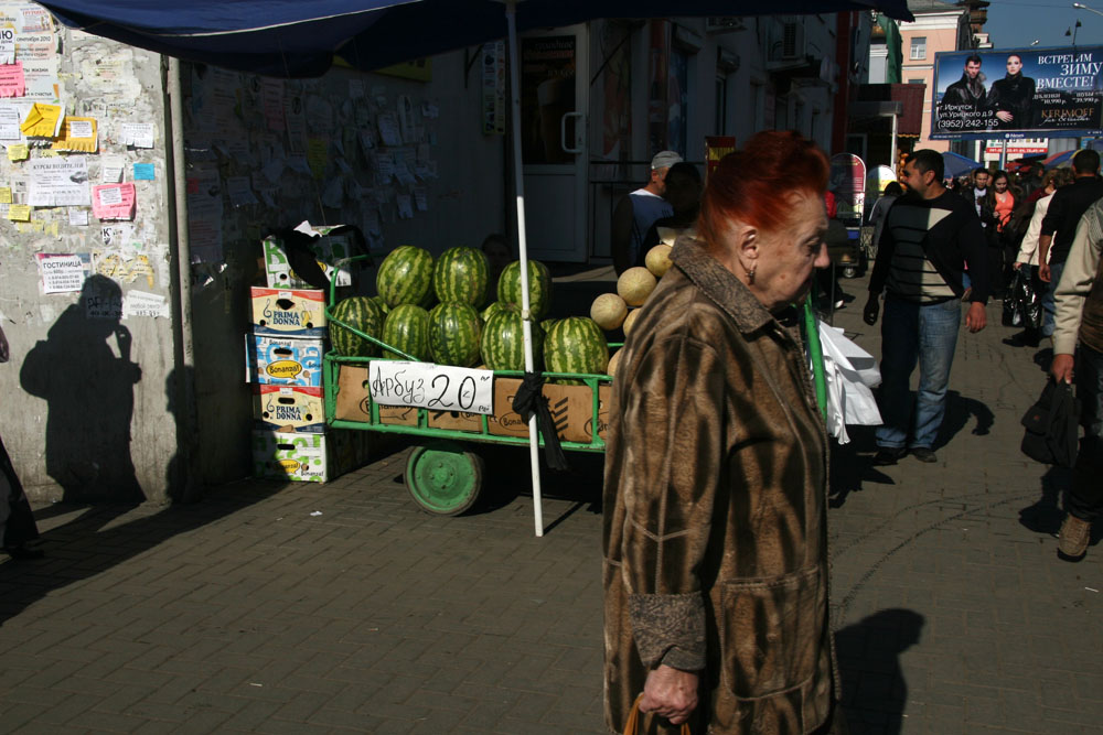
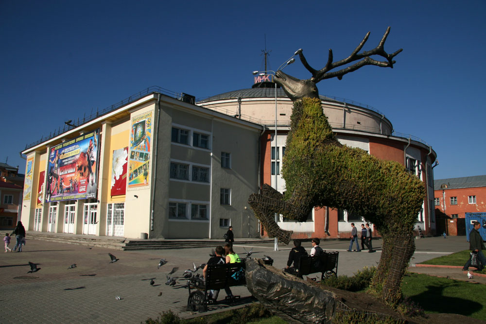
Ten years ago, when travel was altogether an easier undertaking, I travelled by train to Siberia. Following the route of the Trans-Siberian Railway, and taking a few detours along the way, I eventually got as far as Lake Baikal before I turned around to head back home once more. The most easterly city I visited was Irkutsk. Lying at about the same latitude as Birmingham but as far east as Bangkok, it seemed strange after many days of rail travel to arrive in an Asian city that seemed to still cling firmly to Europe, or at least the part of Europe that was Russia.

IMG_7668IMG_7679IMG_7764IMG_7615IMG_7617IMG_7691IMG_7907IMG_7878IMG_7989IMG_7996IMG_8002IMG_7905IMG_8006IMG_7927


Abandoned Ferris wheel

IMG_0300Ferris wheel, Toktogul, Kyrgyzstan

One of the enduring images from Pripyat, the main town in Ukraine’s Chernobyl disaster region, is that of an abandoned amusement park. A totem for the fall from innocence, here are rides that children once played upon but will never do so again. Rising above the park is an abandoned yellow Ferris wheel – a dejected structure that has fallen in grace from a onetime wheel of fun and joy to a symbol of nuclear catastrophe.

At one time Ferris wheels could found in most Soviet towns of a certain size. One former SSR state I know better than most is the central Asian republic of Kyrgyzstan, a country named after the once-nomadic people indigenous to the region. With three revolutions now since its independence in 1991, it is classic example of a territory in transition, a new country of arbitrarily imposed political boundaries that is still trying to find its feet.

IMG_1250View of Manas Square from Bishkek Ferris wheel, Kyrgyzstan

To my knowledge there are at least four Ferris wheels that stand in Kyrgyzstan today, although there may be more. The one in Panfilov Park in the heart of the Kyrgyz capital Bishkek has been upgraded in recent years to replace the somewhat creakier Soviet-era one that stood before. Kyrgyzstan’s second city of Osh in the south of the country has another. This Ferris wheel is older (and a little cheaper) than its Bishkek rival and stands in a city park close to the rather desultory canalised river that flows through the city. Alongside the wheel is decommissioned Aeroflot Yak-40 that has been repurposed as a children’s playground. Both Bishkek and Osh wheels afford excellent city views for an outlay of just a few Kyrgyz som.

IMG_1254Panfilov Park, Bishkek, Kyrgyzstan
There is another wheel, said to be the largest in the country, in the resort of Bosteri on the north shore of Lake Issyk-Kul but the other Kyrgyzstan Ferris wheel that I have personal experience of can be found in the small town of Toktogul halfway between Bishkek and Osh. Skeletal and long abandoned, this one is found at the edge of a leafy park next to a crumbing sports stadium. Old-fashioned fairground rides can still be found in some of the clearings; the wheel, though, no longer turns. With its seats removed – for their scrap value presumably – and left to the attention of the elements, the wheel, framed against the blue central Asian sky, evokes an air of melancholia. Argumentative crows perpetually flock around the structure as if it had always been theirs to inhabit, taunting its immobility with wheeling flight. At one time this over-sized bicycle wheel delighted children and adults alike with its thrilling views of Toktogul Reservoir and the snow-capped peaks of the Fergana mountains beyond. Now it is a wheel that no longer wheels; a rusting reminder of a half-forgotten past unknown to the children who visit the park today.

IMG_0319

IMG_0318

IMG_0307

Crows and abandoned Ferris wheel, Toktogul, Kyrgyzstan

All photographs ©Laurence Mitchell

If you are curious to discover more about Kyrgyzstan you might want to try this…

910lOT0ixPL._AC_UY327_QL65_

To the Lighthouse

img_7066

They are taking the lighthouse down. It was really just a matter of time. Time and tide, it is said, wait for no man, and the two make for a powerful combination on this rapidly changing shoreline. The Orford lighthouse has stood here on the Suffolk coast since 1792, the 11th to stand on the same spot. All the previous lighthouses, mostly flimsy wooden structures, were lost to the sea; this one built by Lord Braybrooke of Audley End has lasted longer than any before it.

The ongoing demolition is simply a matter of being one step ahead of what will happen naturally as a result of longshore drift. Built as a very necessary warning for shipping and continually in service until its decommission in 2013, in more recent times the lighthouse has served as a bold territorial marker for this curious – and one-time secretive – strip of coastline. What it stands upon is not an island as it may seem but a spit – a long stretch of shingle, marsh and sand that sits between the estuary of the River Alde and the North Sea like a curving finger pointing south. Along with an expanse of pylons and weapon-testing ‘pagodas’, this red-and-white band structure has been an icon for the territory of Orford Ness, a place of Cold War secrets, sea-scraped shingle, wildlife and, in recent years, National Trust day trippers. Because of its dark history and evocative, lonely location, the Ness has also seen service as an unsanctioned psychogeographical theme park, a go-to liminal zone for enraptured lone males and Sebaldian shore-shufflers (myself included).

img_7051

While we are all losing a lighthouse, I am losing a gravatar for my blog and twitter feed. I suppose I ought to replace it with something new but I will keep it for a while as a tribute to the lighthouse’s ghosted memory. As for the lighthouse itself, it is hoped that the lantern will be reused to form part of a memorial structure on land across from the Ness on Orford Quay.

Not for the first time have iconic buildings world vanished overnight. The lighthouse’s destruction is, at least, planned and been a long time coming. Other well known places I have visited have met more violent ends – vicious executions rather than gentle euthanasia. I refer to some of these in a post on Palmyra from five years ago. Syria seems like a dream now; something I might have imagined. The reality is that the country I experienced as a welcoming place nearly twenty years ago has since become a land of nightmares.

SYR006LM          syr025lm

Going further back in time, it feels equally strange to recall having once spent several days in a hotel that overlooked the enormous sandstone Buddhas of Bamiyan in central Afghanistan. This was back in the halcyon days when the country was a way-station on the so-called Hippie Trail to India, long before the Taliban decided to blow the Buddhas up as blasphemous objects of idol worship (even then, the statues’ faces had already been disfigured by angry iconoclasts).

To continue a tally of Zelig-like appearances at places associated with doomed futures, I might also mention a visit to the World Trade Centre in New York on my first visit to the city in 1986 – of having once stood in a small room at the very top of the structure, a space that now existed as just a cube of empty sky above a disaster zone. Or a visit to a place that languished in a void between destruction and repair: Mostar in Bosnia and Herzegovina, still a broken city when I visited in 2003, the absence of its beautiful 16th-century Ottoman bridge hanging like a question mark above the rubble-filled turquoise of the River Neretva. The bridge was faithfully rebuilt with foreign investment and reopened in 2004. As beautiful as before but somehow sad and perhaps even futile, the reconstruction was a gesture of hope more than anything else — the Muslim east and Croat west banks of the river would remain as places apart in terms of religion, culture and political allegiance.

Less exotically, I also recall the cooling towers that used to stand next to the M1 in Tinsley, Sheffield – twin behemoths that could be seen from the windows of the school where I did my first teaching practice in the city. The towers, devoid of function since 1980, possessed a grace and heft that seemed to perfectly symbolise Sheffield’s industrial past (as did the abandoned steelworks of the Don Valley, which were eventually cleared to provide the land for the inevitable – a massive shopping complex, Meadowhall). Like the Orford lighthouse, and also the equally iconic cooling towers that stood at Ironbridge until last year, the Sheffield towers were finally expunged from the landscape. It took just seven seconds to reduce the 76 metre towers to rubble. For now, like the Orford lighthouse, they remain as a memory, a ghost of landscape that will fade with time.

The Shrieking Pits

IMG_8413

Tucked away in the north Norfolk coastal hinterland, close to the villages of Overstrand and Northrepps, is a group of small ponds known as the Shrieking Pits. More of the same can also be found a few miles further west near Aylmerton close to Felbrigg Hall. Thought to be early medieval excavations for iron ore, the resultant pits have long been filled with water and softened by vegetation to allow them to blend in with the scenery as if they were natural features in this gentle post-glacial landscape.

Seeking them out, we made our way on foot from Overstrand, following the Paston Way inland through dark woodland and prairie-sized fields of barley and oilseed rape. The pits lie amidst arable land just beyond a farm at Hungry Hill, a name that points towards agricultural impoverishment at some time in the past. The pits stand beside a green lane, a byway of some antiquity that may have been here as long as the excavations themselves.

IMG_8411

The first one we come across is small, surrounded by willows of a uniform height. In the ring of tree shade that encloses the shallow pond, a wooden palette left over from some undefined farming business lies next to the water liked an abandoned raft. The main ‘pit’ is nearby, an altogether larger and more impressive pond edged in by semi-recumbent oaks. The water is glassy and ink-black, suggesting great depth and perhaps a little menace. On the far bank the surface is coated with pond weed the colour of puréed peas. A small wooden notice board has been placed next to one of the oaks is but it is bare, its writing long gone to leave it devoid of information other than that which can be told by wood grain alone. Despite this unwitting redaction, a tangible sense of genius loci suggests that there is something to be told of this place other than a chance meeting of trees and water.

Naturally with a name like Shrieking Pit there is a strong likelihood of dark legend. The mundane answer is that the name alludes to the sound emitted by the exposed gravels. But does gravel really shriek? It scrapes and it crunches but does it make a noise quite so dreadful? Shriek is a loaded word, a term that evokes emotion – fear, dismay, even terror. It is these qualities that inform the folklore associated with the place.

IMG_8414

The story goes that a grieving young woman haunts the locality. It tells of a heartbroken 17 year-old called Esmeralda who was seduced and then abandoned by a duplicitous local farmer. Inconsolable, the desperate young woman is said to have thrown herself into the water of the pit one dark night before immediately regretting her decision and crying for help that did not come. Her unheard cries are said to be heard at the spot each February 24th, the anniversary of her death.

Another story tells of a horse and cart vanishing without trace in the pool’s murky depths. Looking at the black unreflecting water it seems perfectly possible. Places such as this, although mere dust specks on the map, are the bread and butter of rural folklore. Such places inevitably become repositories of legend – features where the landscape can be painted with tales of intrigue, romance and horror. As the notice board is currently blank perhaps we should feel free to write our own story.

IMG_8416

References:

http://www.heritage.norfolk.gov.uk/record-details?MNF6787-Shrieking-Pits

https://www.hiddenea.com/norfolkn.htm#northrepps

The Mountains of Persia

101_2693

There is a bar in Belgrade called the World Traveller’s Club. It is in the basement of an apartment block in the city centre and to gain entrance you are required to ring the door bell at street level and state your business over the intercom. These days the club, which is alternatively known as the Federal Association of Globetrotters, is just one of many quirky bars in the city – homespun decor, art school daubings on the walls, miscellaneous furniture that includes Singer trestle sewing machines for tables, posters of iconic foreign destinations like Paris and Rome. The bar, as it proudly declares on its menu, was established in 1999. The date is significant.

In 1999 Belgrade was the capital of a land still known as Yugoslavia, a much depleted country that by that stage of the breakup consisted of just Serbia, Montenegro and Kosovo. Internationally, the country was considered as a pariah state thanks to the continuing ultra-nationalist regime of Slobodan Milošević. 1999 was also the year that NATO bombs fell on Belgrade and other Serbian cities. It was neither a good place to be nor somewhere that was easy to escape from – a Yugoslav passport, once a document that allowed easy access to both West and Eastern bloc, no longer held any currency. Such a document would get you nowhere.

It goes without saying that not everybody in Serbia was happy with Milošević’s stubborn and didactic rule. Most young people in Belgrade just wanted to do what young people did everywhere – live, love, make mistakes, have fun, travel. Many of these were still possible to some extent but travel was clearly out of the question. As a reaction to this difficult state of affairs a few people came together to create the World Traveller’s Club, a safe welcoming environment where people could meet to travel in their imagination if not in real space. Initially membership was by invitation only. These days anyone can visit although the bar’s original purpose no longer holds much significance other than a reminder of difficult times.

Turn the clock back thirty years, back to a time when foreign journeys required a wider leap of the imagination. In the pre-Internet age any inspiration for travel for its own sake was dependent on books, photographs and the anecdotes of others. In the 1970 film Performance, the Turner character, a reclusive rock star played by Mick Jagger as a caricatured version of himself, reads aloud from a Persian text, The Old Man of the Mountains. A postcard is displayed entitled The Mountains of Persia. Both text and image represent a sort of paradise – that which is unattainable, a dream destination for the two men thrown together in self-isolation in Turner’s Notting Hill Gate basement. Turner is living as a recluse, hiding from fame and perhaps the fear that his powers are diminishing; Chas, the James Fox character, is keeping a low profile to avoid the attention of fellow gangsters. The idealised mountains of Persia represent a sanctuary where both men might manage to escape their past lives.

The curtailment of free movement as in late 1990s Yugoslavia is hard to imagine these days. Many of us in the developed world take travel for granted almost as a birthright. This is especially true in an age in which jet travel is both cheap and easily available, and a journey, a holiday or even an off-the-peg adventure, can be booked with the click of a return key. Now, suddenly, in the light of a rapidly worsening pandemic, we need to think anew. We must accept that for a while at least, probably some considerable time, we are not going anywhere. Perhaps now is the time to form our own fraternities and sororities of imagined exploration? Any globetrotting must be virtual and digital. For the foreseeable future wanderlust is going to be just that, a lust for something unattainable. In this respect I am lucky I suppose. For a number of reasons, in recent years I have come round to thinking that it is just as fruitful to explore my own backyard as it is any exotic far-flung destination. I have grown weary of airports and the mechanical human processing that takes place, the tiresome, albeit necessary, security measures. As B. B. King sang of another sort of love affair, The Thrill Is Gone. The notion of ‘slow travel’ and all that it represents has for me become something that has gone beyond simply an attractive-sounding travel franchise. These days I really do prefer to slow down, to cover a smaller area, to discover the beauty of the local, to chart the quotidian. Less is undoubtedly more but that is easy to say for someone like me who already has the T-shirts, the passport stamps, the photographs, the anecdotes, the well-thumbed guidebooks on the shelves.

In the plague-year situation that the world now finds itself in to complain about restricted movement seems, at the very least, churlish. As we enter what seems like late capitalism’s final closing down sale (‘Everything Must Go!’) we have become, as the columnist Marina Warner has recently written, ‘a nation of shopfighters’. While shoppers squabble over toilet paper in supermarket aisles and some wealthier hoarders, like newly arrived Beaker folk mocking the simple ways of those who still rely on cupped hands, purchase additional freezers for the storage of their panic-shopped supplies, we should maybe reflect on what we (or, rather, some of us) have become. It is an opportunity perhaps to show a little more respect to the land that we walk upon, for the earth that feeds us; a little more kindness to those we share it with. For the time being we can just look out of the window and dream. At the other end of all this the mountains of Persia will still be there.

101_2707

Photographs: Karakhanad, Yazd region, Iran 2008  ©Laurence Mitchell